

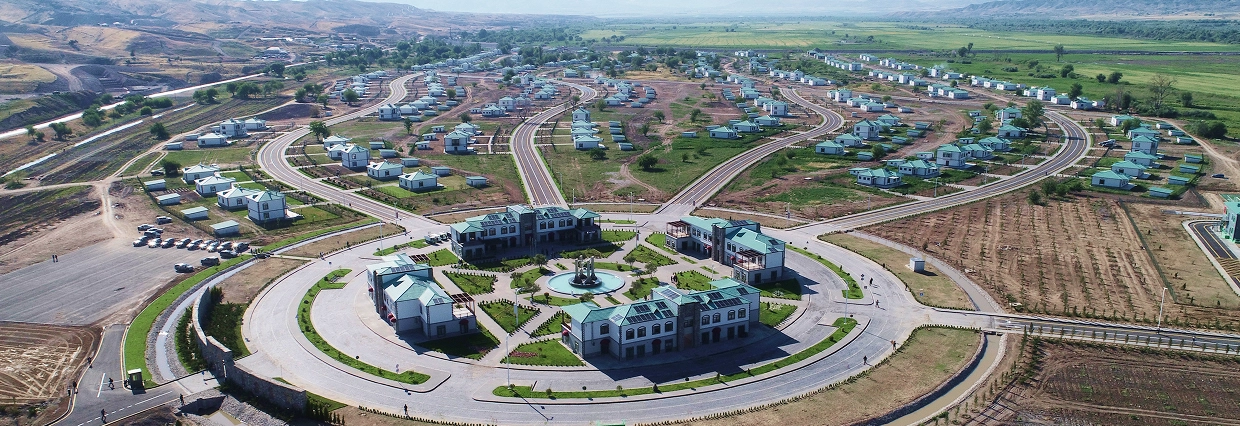
Master Planning of Kangarli Village
- Completed work: Geodetic, geological, hydrogeological surveys and detailed topographic mapping of the site.
- Location: Kangarli Village, Aghdam District
- Year: 2022
Master Planning of Kangarli Village
The planning of Kangarli village is one of the key initiatives within the broader reconstruction efforts of the Karabakh region. Conducted in 2022, the goal of the project was to support the resettlement of local populations and establish a sustainable rural infrastructure. At the planning stage, full geotechnical and engineering assessment of the area was essential.
Geoqazma was responsible for geodetic and topographic surveying, engineering geological analysis of soils, and hydrogeological assessment. Detailed mapping of terrain, soil layers, and underground water flows was conducted. Critical risk factors such as flood potential and land stability were analyzed to determine suitable zones for construction.
Using GNSS and drone-based equipment, our team generated high-precision digital terrain models and topographic maps. These outputs were instrumental in preparing the architectural and master planning documentation of the village and ensuring a safe foundation for future development.