

Reconstruction Planning of Məmmədbəyli Village in Zangilan District
- Completed work: Geodetic and geological studies, soil and terrain analysis, topographic mapping.
- Location: Məmmədbəyli Village, Zangilan District
- Year: 2022
Reconstruction Planning of Məmmədbəyli Village in Zangilan District
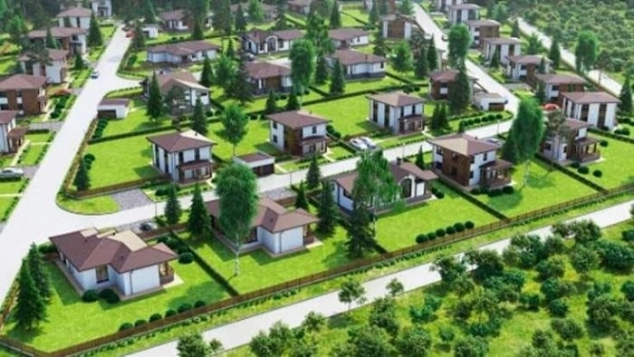
The reconstruction of Məmmədbəyli village is a key component of Zangilan's regional development and the sustainable resettlement program in liberated territories. The project aimed to plan residential buildings, public facilities, and essential infrastructure for the returning population.
Geoqazma conducted extensive engineering-geodetic and geological studies. These included analysis of the terrain, physical and mechanical properties of the soil layers, groundwater levels and flow directions, as well as the identification of geological risks such as landslides or flooding. Based on these findings, suitable construction zones were identified and the spatial planning of the village was aligned accordingly.
Using advanced GNSS and total station equipment, high-precision digital topographic maps were created. These outputs formed the foundation for the architectural and engineering design documentation.